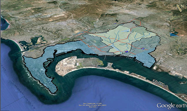
Characterized by intense urbanization, complex infrastructure, wide income disparities, rich histories of culture and nature, and tremendous intellectual capital, the Pueblo Watershed presents many challenges and opportunities.
See the Pueblo Watershed through photographs by community members.
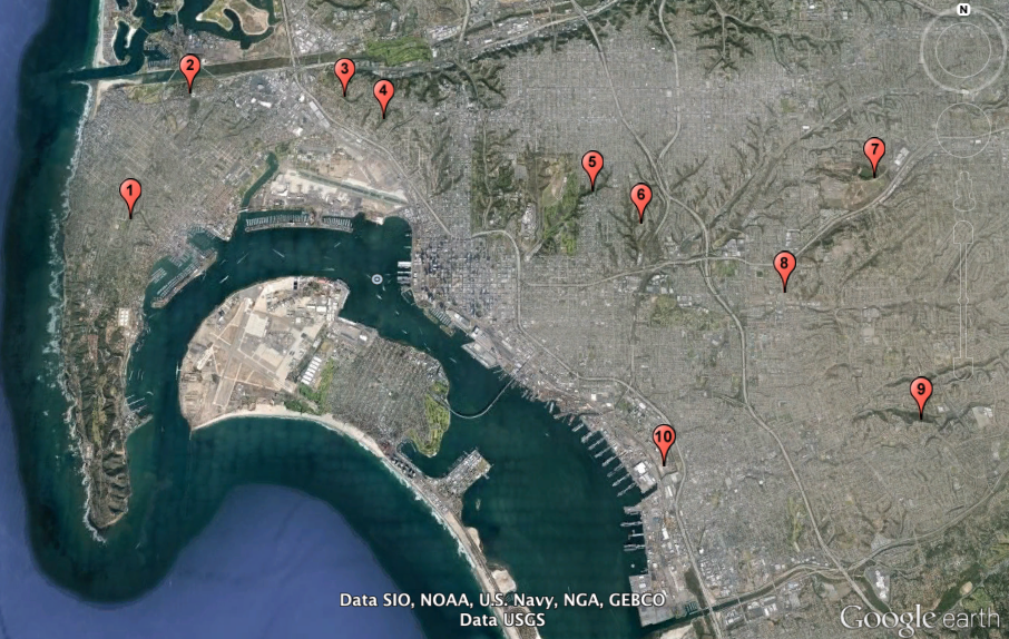
Teams visited the following sites:
Sycamores and pavement follow this canyon through Point Loma’s La Playa neighborhood down to Shelter Island.
A coastal wetland along the San Diego River, now surrounded by homes and businesses, reminds us how San Diego Bay used to be.
Victorian Homes mark the Americanization of old San Diego near the northern boundary of the Pueblo Watershed.
In affluent Mission Hills, a neighborhood canyon with coastal chaparral drains toward the airport.
Along the eastern edge of Balboa Park, dividing North Park from South Park, citizen activists saved this winding canyon from urban development.
A many-branched canyon carves up the neighborhood of South Park, creating a refuge for plants, animals, and people.
Built in 1901 to provide drinking water to the growing town of San Diego, the reservoir’s original function was compromised by upland urban development.
Redevelopment in the Diamond District enhances awareness of Chollas Creek while celebrating the neighborhood’s rich cultural diversity.
Near the southern boundary of the Pueblo Watershed in National City, this remnant of open space evokes the varied history of native people, ranchers, and subsequent urbanization.
Where Chollas Creek enters San Diego Bay, freshwater run-off meets tidal influence in an industrial, military, urban setting.
Pueblo Watershed Site Locations


